Pyrenees lakes (ibones)
The ‘ibones’, name used in Aragón to designate the glacier-origin high mountain lakes, have a great landscape value and are unique in the Iberian Peninsula given its formation. Going through any of the tracks that lead to them is one of the best ways to visit special hideouts of the Pyrenees.
Some of these lakes, in particular, the ones of Benasque Valley, are easily accessible, while others need more physical effort for being visited. However, this is not that important if we compare it with the felt satisfaction once we are in front of such a nature whim. Regarding those lakes that require a more exigent access, there is nothing better than going with an experienced guide who guarantees a safe route and explains everything along the way.
Escarpinosa lake
Without any doubt, Escarpinosa lake is one of the most well-known ‘ibones’ in Benasque Valley and probably the most accessible one. In the foothills of Aguja de Perramó, the lake surroundings are undoubtedly one of the most spectacular of the Pyrenees.
The hike to this lake is a must-route inside Posets-Maladeta Nature Park. In a 5 hours round-trip, we will enjoy different landscapes that will not let us down.
The first stretch goes up Estós Valley coinciding with the marked track GR11, a progressive forest track that runs next to Estós river; the second section ascends abruptly through a pine and beech forest finishing in Batisielles small lake (ibonet). At that point, the route splits into two: one path goes to Batisielles lake and the other goes to Escarpinosa lake. To arrive to our objective, we will come across a third stretch that runs between streams and a waterfall.
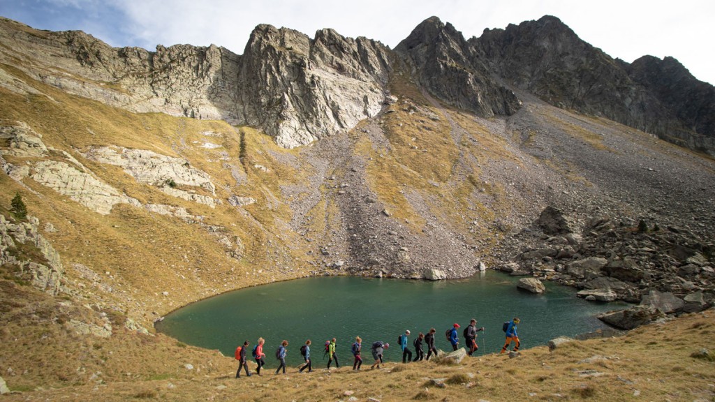
Gorgutes lake and Glera mountain pass
According to some hikers, Gorgutes lake has the best views of the Pyrenees since one of its main appeals is undoubtedly the spectacular views of Maladetas massif and Aneto’s glacier.
Once we reach the lake, we also can arrive to Glera mountain pass continuing around 10 minutes more through the track. This pass, border limit between Spain and France, brings us a special view of the French valleys, something that makes this lake hike one of the most complete ones of the Pyrenees. The hike begins at the end of the road that crosses the valley from the north to the south. After ascending through a pine forest, the track runs through meadows and crosses Gorgutes cliff at a wooden bridge where the slope softens.
The route continues through easy terrain until reaching the lake in at approximately one hour and a half from the beginning.
Remuñe lakes
Located in a wild and stunning landscape straddling the cliff named after it, Remuñe Valley (Ball de Remuñe)has 6 km depth and a vertical drop that far exceeds the 1,000 metres. Remuñe lakes are two small blue blinding lakes hidden in this marvellous valley.
The hike to its shore allows gazing at a plentiful vegetation of black pines, mountain ashes, rhododendrons and blueberries, as well as many flowers and high mountain species.
The route starts shortly before the end of the main valley road, at a signpost that indicates the access to it. The ascent starts between pines, pastures and stones on the right side of the valley until reaching a flat area known as Plleta d’es Capellans. At that point, where the valley channels between banks, we have to continue towards the right cliff reaching another flat area known as Plleta de Remuñe.
We have to cross the river through a metallic bridge and take the southern path that climbs to the highest and smallest lake. In order to reach the lower lake, we head to the east surmounting a small pass where we will already manage to see our final point. The way back is retracing our steps.
The round route length is of approximately 5 hours.